A weekend adventure in the autumn…

It’s rainy, stormy and wet… The perfect conditions to go out, and enjoy the autumn to it’s fullest! This weekend “Adventure Henk” and I will go for a short mid autumn adventure in the “Biesbosch”. This is one of the many national parks we have in the Netherlands. The last journey we did was a 160 kilometer walking trip, and it was exhausting, hard, wet, tiring and rough. So all in all it was great! I strongly believe in doing new things, therefore I’ve been searching for a sort of transportation I’ve never (or hardly) used before. The KAYAK… The Biesbosch is one of the last extensive areas of freshwater tidal wetlands in Northwestern Europe, so a kayak was the natural way of moving around.

Schermafbeelding 2014-10-22 om 13.25.14

Many people would think: why would you go out in autumn weather like this? Why would you sleep in a tent, or in a bivvy bag in the cold weather? I ask myself: why would I hang out on a couch watching crappy TV, if I can be out there in the fresh air? It’s the feeling of being outside, in the nature that makes me feel alive. Sometimes you just need to get out of your comfort zone to appreciate what you have. And when that is done with a kayak in the Biesbosch, it sounds like a proper way to energize yourself to me! Just being out for a couple of days gives me the energy in need during the week. Although the weather is rainy, wet and cold right now Im looking forward to spend a couple of nights in the Biesbosch…

oosthaven-biesbosch-387677

It’s just a short weekend microadventure. It doesn’t have to be a month long expedition. We will make a short film about it, and write about it. Then we leave it behind us, for others, as an inspiration for going out there yourself.

I want to say thanks to Vissershang canoe and boot rental for helping us with the Kayaks!

Without-a-map day 3 &4: Coo and back!

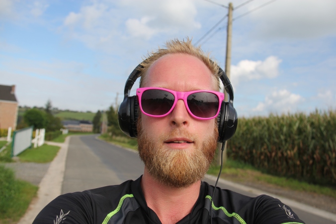
This is the story of a guy who finds out what it is to get lost. Just for the sake of experiment, and for the love of cycling! If you would like to know why this guy is doing this, you can click –> HERE. Or you can start at part 1 or part 2 of this epos…

This would be the third day of my trip. I was almost in Coo, Belgium, all the way from Maastricht, NL. Around 80 kilometers from the beginning point. When I woke up in the early morning I felt good. The night was fresh and dark, and gave me enough energy to bike to Coo and maybe even back in 1 day. The weather was good, and it seemed to become a warm day. After a refreshing wash in a small stream I got on my bike and cycled the remaining 10 kilometers to Coo.

Schermafbeelding 2014-10-16 om 22.49.21

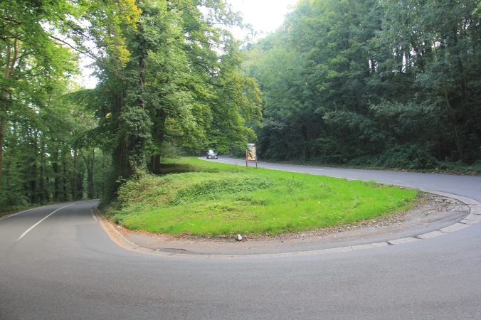
The roads went up and down, up and down and even more up and down. But before I knew it I was in Coo! I’ve made it! Now, Coo is not like a paradise… I mean, it’s nice but far away from the place I’ve camped my first time. It was a touristic spot; lots of cafe’s, restaurants and a beer for 4 or 5 euros. No thanks, I’ll rather have a swim in the river and be on my way back to Maastricht again!

Schermafbeelding 2014-10-16 om 23.07.04

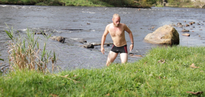
Washing all the salt from my body felt good! Thats the thing with cycling and camping out in the forrest for some days; when the opportunity of  washing comes by, don’t let it go! The next time you have this change might be in a couple of days! The layer of salt on your body might keep you a little warm in the winter, but I rather be fresh and without a layer of salt…

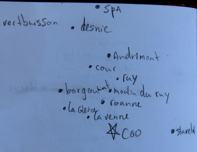
For sure I wasn’t planning to take the same way back, and after some kilometers I found a bus shelter with a map in it. So once again a own map was made, and I followed my way trough the beautiful Belgium landscape. My wheels rolled trough tiny villages, rocky trails and big roads. It was great, the sun was constantly shining and I enjoyed the fresh indian-summer-air. Sadly enough my bike didn’t have anything that shows how fast it went, because at some point I was on a big road, only going downhill for at least 15 kilometers. My ears plopped because of the descent, and this is rare for me as a dutch guy! I’ve must have been going at least 50 kmh… I celebrated this with a cola at a hotel, and when I cycled away, my eye fell on a map. Yes! I checked out the map, and saw a place with trees. By now the Ardennes were behind me, so you could imagine I was happy to see a green spot on the map!

IMG_8919

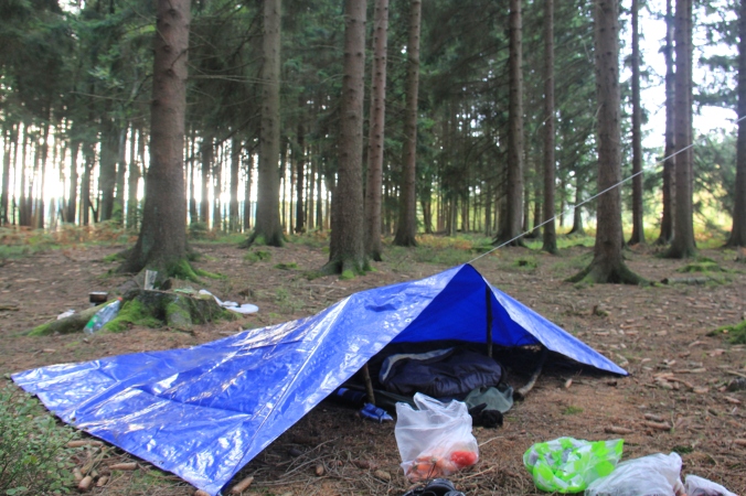
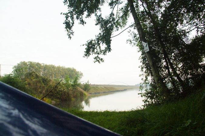
When the forrest was approached I found myself in the middle of beautiful farmlands. It was a little before 19:00 so there was enough time to find a spot, set up camp and cook. At the entrance of the forest was a big sign with the rules; No dogs, No walking outside of the paths, No open fire, No camping, No taking pictures when your camera is too loud… Damn, it was clear the Ardennes were behind me. Next to all these rules there was a sign with a guy and a gun. Did it mean people were shooting or hunting here?! On the sign were also times: 6-9 & 19-22. I quickly figured out the guys with guns must be foresters and they will shoot on sight between 6 & 9 and 19 & 22 o’clock. I just had little time left. Quickly I jumped into the forest and found a place for me and my bike. I marked the road and went up to a bench I saw earlier, to cook while I witnessed how the night would fall over the Belgium countryside. Time to make some pictures!

IMG_8825

IMG_8860

IMG_8881

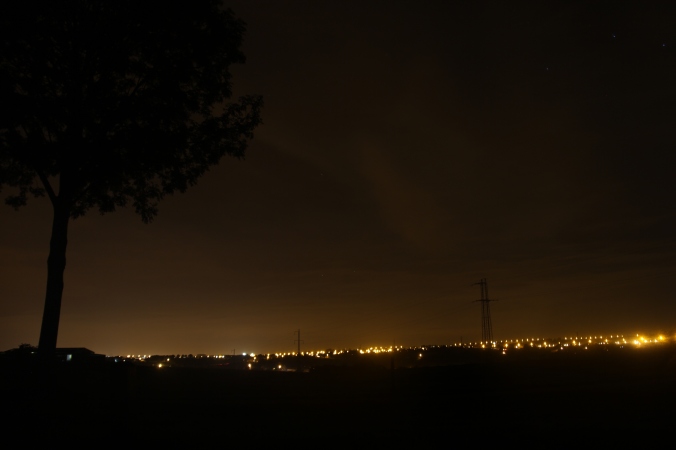
Sitting there watching the sun go down I felt like a homeless person. I was stinky, cooking on a bench and drinking wine straight from the bottle. And I loved it. These are the moments where tranquility is boss. Sitting, waiting till it gets dark, watching the sky change from blue, to pink to purple and eventually to pitch black. These are the moments where life doesn’t fly by, but slowly goes by, minute by minute and second by second. A moment to reflect on your actions and where you stand in life. And to realize that wine tastes best straight out of the bottle.

A little after 22:00 I walked towards my place into the bush. Quickly I jumped in, and dragged my bike in there. Once cam was set up I crawled in my sleeping bag and heard the forest. This was by far the most loudest forest I’ve ever came across! Everything was squeaking, breaking or falling… Good backgrounds for a wel deserved rest!

IMG_8882

An early alarm clock woke me up before the foresters could, and after a breakfast with the strongest coffee ever (I ran out of water…) I continued my way to Maastricht. There were a couple of hills to conquer, but all in all it went quick. Mostly the road went downhill, and soon I found myself in Holland again. Cycling the last kilometers I noticed the same mountains as I started this trip, but now on the other side.

The feeling of getting lost was certainly there the last days, especially in the beginning. After some time I found a way to navigate by making my own maps. If I wouldn’t have set the rule of allowing myself to make maps, I think it wouldn’t be possible to do it in 3 to 4 days. There are people who did a continent without a map. Or cycled across India only to navigate with the sun and asking people for directions. Adventure can be found everywhere, and when you take away the certainty of a map, adventure crosses your path. In this time of GPS, smartphones, ipads and all the navigation devices it’s great to go out without a map. You take the roads you WANT to take, not the roads you HAVE to take or the devices tell you to take. In the end you’ll get to your end goal, don’t worry… It might just take a bit longer.

I reached my end goal in time for a good “patatje met”!

IMG_8909

I can see myself going on more “Without-a-map” trips. Getting lost, finding hidden paths and exploring unknown territories that might just be around the corner. But for now Ill keep my maps in my cupboard and don’t burn them yet!

Without-a-map: Day 2 … to .

This story is about my attempt to travel from Maastricht (NL) to Coo (BE) and back in 3 days, without a map. Maybe you want to read the first part or maybe you want to know why I do this. But for you who keep on reading I can tell you how I woke up from the last night. Full with energy, and ready to cycle to Coo! At this point I didn’t really know where I was, but knew which village I wanted to go to. Directly I knew asking people for directions was the best thing to do. Now my French is really bad. Or, better to say, there is no French. So it would be a matter of talking with my hands and feet. Within 2 hours I was on 180 degree curves going up, and I knew it was the right direction.

IMG_8765

At 9 in the morning I started cycling because I had no idea how far it would be towards Coo. The day before I just cycled 2 hours, and crossed the same bridge 4 times, so of this 2 hours, 1,5 was really cycling… I HAD to reach Coo quite early today, otherwise I wouldn’t get my deadline of being back in Maastricht at 16:00 the next day. The hills were getting steeper, the forrest became more dense and i noticed the area just became more beautiful. Things were going well!

IMG_8767

The map I’ve drawn for myself was working pretty well. In every village I asked a person for the next village and how to get there. Mostly I pointed to the way I thought was right, and said the name of the village, with a question mark behind it. That seemed to work pretty well. The best thing was that all the villages seemed to be just 3 or 4 kilometers apart! This meant I rapidly from place to place on my map, and if nothing weird would happen I might arrive in Coo in the evening!

IMG_8780

It was a bit further then I thought and saw that it was not possible to get to Coo in the evening. This evening I wanted to have a nice place to make a camp, somewhere in the forrest, and I wanted to make camp before darkness would fall. There is nothing nastier then setting up camp in the pitch black darkness. By this time I was in the true ardennes, and knew there must be beautiful places to camp. I set off to the forrest, made camp, cycled a bit around and sat down for a well deserved glass of wine. I cycled 11 hours up and down in the hot autumn sun, and was exhausted but satisfied. In one and a half day I almost reached my destination without a glimpse on a real map!

IMG_8798

Tonight would be a meal of kings, made on my little stove. Bacon, beans, onion, carrots and spicy sauce. It smelt really good, and I think I was not the only one who thought that… It was pitch black dark at the place where I set camp, and all of a sudden I heard a loud roar about 50 meters away. The roar went trough my bones and all my senses were immediately working for the whole 100 percent. I heard the animal walking, and don’t know why but I turned off my headlight. Now I was sitting in the pitch black dark, and couldn’t see anything! The animal came closer and closer, and I felt my heart beating in my throat! After some seconds I heard the animal was so close, so I turned my light back on, and shone the animal straight in the eyes. It was a huge red deer! It wasn’t further then 10 meters away from me, and when I stood up, the deer slowly walked away… Now I don’t have any experiences with these kind of animals, but when you’re alone in the forrest, in the middle of nowhere, it makes your heart pump faster! For the night I decided to put my bike in front of my bivouac so no animal could get in, and I had at least some feeling of safety.

IMG_8786

IMG_8794

It was pretty easy to find my way towards Coo. Everything just took a little more time, since I had to ask people for direction every 30 minutes. And in French. But it worked out, the people where helpful and somebody even drew me a map of how to get to the next village. It seemed traveling without a map wasn’t too bad, as long if you find your own way to get around.

IMG_8918

I would reach Coo, thats for sure, but would i make it back in time? Two days were left, and for sure I wasn’t taking the same way back! But that will be for the next time!

Without-a-map: Day 1, Maastricht to …?

IMG_8893

Imagine: you have no map but you need to go south. There is a river going south, but the road just stops and ends up in a garden. You bike back. No, now you go north. Trying numerous ways to go south, but the road only leads you north or east. You have no map, and the only guideline you have is the river, but there is no way to follow it… And then…?

IMG_8740

The weather was good, the autumn is coming so I decided to squeeze in a small adventure before its too cold or rainy to sleep outside. I had the idea to travel Without-a-map. Why? You can read that here. After 4 and a half hour ride to the Limburg (Maastricht to be precisely) I arrived at the train station around 16:30, armed with a compass, a book and some pencils. Just 3 hours before the sun would set and darkness would kick in. Walking around the station I quickly found a map of the area, and made my own little drawing of it. The city was devided by a big river, “The Maas” and I saw it went south. That’s where I needed to go! So I followed the river, after taking care my (waaay to heavy, who packed all that food?) wouldn’t fall of my bike every 20 meters, and quickly found myself in Belgium. It was relative easy till this point. Just 100 meters into Belgium me and my bike came across a huge highway with a cycling path next to it. Is this the right way? Left or right? This would be a moment one would look on a map to know where to go, but instead I looked at my own made drawing.

IMG_8910

IMG_8911

It told me nothing, but my compass told me to go right. There was the river again, with a bridge, so I crossed it and was on my way again. After following the river for some kilometers the path ended, and I had to go into a village. Dusk fell over Belgium and still no place found to make my camp, or a useful way to make a map for myself. Just at the moment that I thought: “shit, I’m never getting out of this village, a bus shelter popped up with a map of the area! Woohoo! With a smile on my face, and renewed energy I quickly found a way to make myself a map.

Schermafbeelding 2014-10-04 om 13.06.21

IMG_8912

IMG_8913

My objective for the day was done, making a map that I could use to get to Coo. Now to find a place to make camp for the night. Most of the times the map would provide me with green spots, and I would check it out if its camp-able. In this case it meant biking around till I found a place somewhere. But I had to be a bit quick because it was already getting dark. After biking around for some time (crossing the same bridge 4 times) I found a place next to a construction site. It was a nature area, where lots of beavers also making their camp for the night. Without a map this place was a true discovery. A small lagoon on a place where I already saw myself sleeping on the side of the road…

IMG_8757

IMG_8758

In the Beginning of the trip I really felt lost. The uncertainty of not having a map or a orientation point was a bit frightening as well as exciting. The first hours were just about finding orientation points, to see where I actually am, and where I would have to go, to go more south. I was so happy when the map with my beginning point and Coo on it was in the bus shelter! Traveling without a map creates the sense of adventure I’m looking for, the appreciation of small things(like a map in a bus shelter), the uncertainty of where to end up, and how to deal with these kind of situations. Because how do you get to point B when you have no idea where point A is?

Schermafbeelding 2014-10-04 om 13.01.05

The next days were easier because I made a good drawing, but now the area became really hilly, and there was even an nightly encounter with a curios red deer… But this you can read here!